
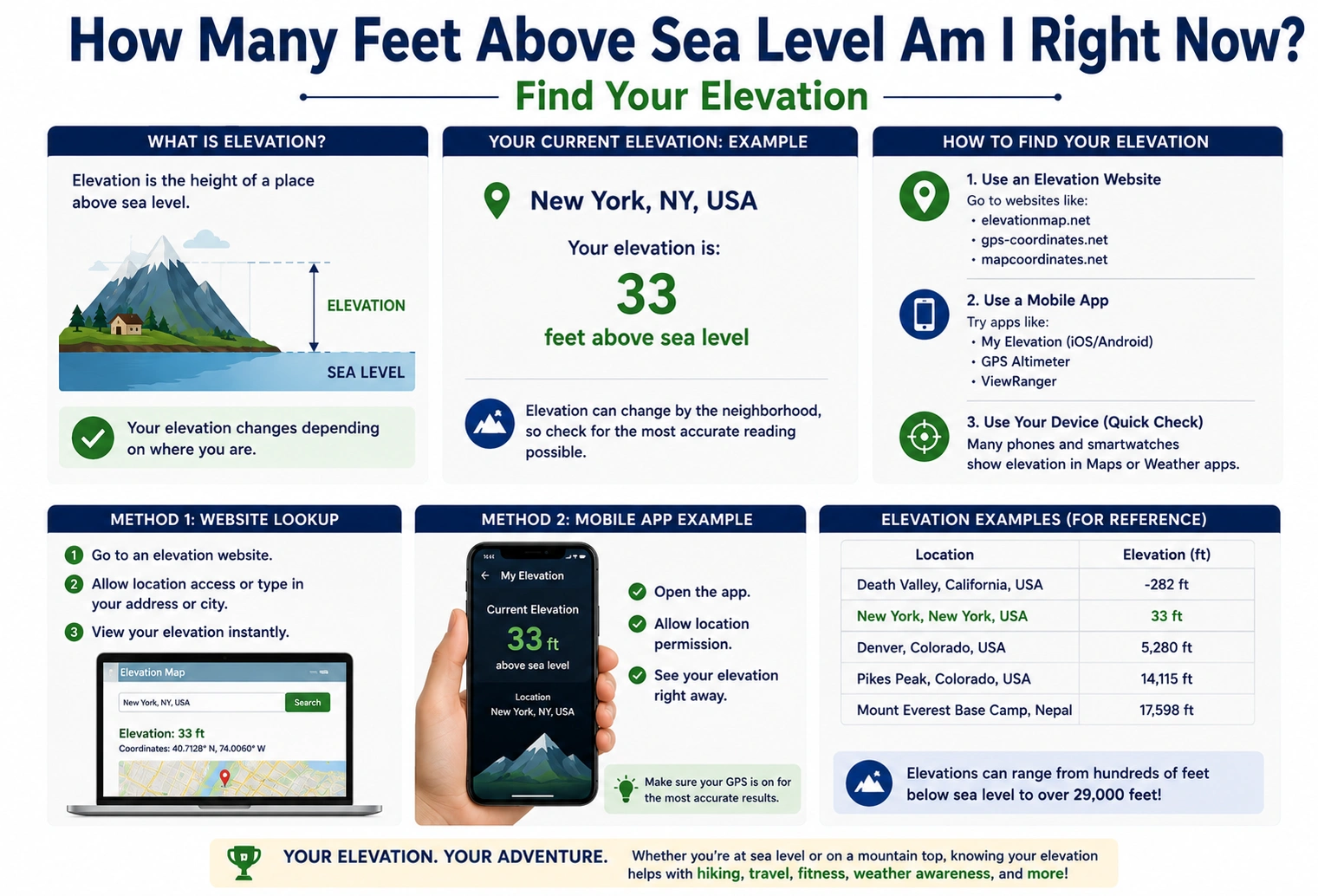
If you’ve searched how many feet above sea level am I right now, you’re probably trying to find your current elevation. Whether you’re hiking, traveling, checking weather conditions, planning a construction project, or simply curious, knowing your elevation above sea level can be useful.
The exact answer depends entirely on your current location. Since elevation varies from one place to another, there isn’t a single number that applies to everyone. Fortunately, modern smartphones, GPS devices, and online mapping tools make it easy to determine your elevation within seconds.
This guide explains what elevation means, how it’s measured, and the best ways to find your current height above sea level.
Quick Answer
Your current elevation depends on where you are.
To find how many feet above sea level you are right now, you can use:
- Your smartphone’s GPS
- A GPS navigation device
- Online elevation finder websites
- Digital topographic maps
- Hiking or outdoor navigation apps
Most modern smartphones can estimate your elevation when location services are enabled.
What Does “Above Sea Level” Mean?
Elevation above sea level is the vertical distance between your location and the average level of the world’s oceans, commonly referred to as mean sea level.
Elevation is usually measured in:
- Feet (United States)
- Meters (most other countries)
For example:
- Sea level = 0 feet
- 500 feet above sea level = moderate elevation
- 5,000 feet above sea level = high elevation
How to Find Your Current Elevation
There are several easy methods.
Using Your Smartphone
Most smartphones include GPS sensors capable of estimating elevation.
Many built-in compass or mapping apps display altitude when:
- Location services are enabled.
- GPS has a strong signal.
Dedicated elevation apps can also provide your current altitude.
Using a GPS Device
Handheld GPS units commonly display:
- Elevation
- Coordinates
- Speed
- Direction
These devices are popular among:
- Hikers
- Hunters
- Surveyors
- Campers
Using Online Elevation Maps
Several websites allow you to:
- Enter an address
- Search a city
- Click on a map
They then display the elevation for that location.
These tools are useful when checking locations before traveling.
Using Topographic Maps
Topographic maps show elevation using contour lines.
They are widely used for:
- Hiking
- Engineering
- Land surveying
- Outdoor recreation
Although reading contour lines requires some practice, they provide detailed terrain information.
Why Elevation Changes from Place to Place
Earth’s surface is not flat.
Elevation varies because of:
Mountains
Mountain regions may reach thousands of feet above sea level.
Hills
Rolling terrain produces moderate elevation changes.
Plains
Flat regions often remain only a few hundred feet above sea level.
Coastal Areas
Many coastal cities sit close to sea level.
Average Elevations in Different Areas
Here are general examples:
| Location Type | Typical Elevation |
|---|---|
| Beach | 0–50 feet |
| Coastal City | 10–200 feet |
| Rolling Hills | 500–1,500 feet |
| Mountain Town | 3,000–7,000 feet |
| High Mountain | 8,000+ feet |
Actual elevations vary depending on the specific location.
Why Knowing Your Elevation Is Useful
Knowing your elevation can help with many activities.
Hiking
Track climbs and estimate trail difficulty.
Weather
Elevation influences temperature, snowfall, and rainfall.
Construction
Builders often consider elevation when planning drainage and foundations.
Health
Higher elevations have lower oxygen levels, which can affect some people.
Aviation
Pilots rely on altitude and elevation information for safe flight operations.
Common Mistakes When Checking Elevation
Confusing Altitude with Elevation
- Elevation refers to the height of a location above sea level.
- Altitude often refers to the height of an object, such as an aircraft, above sea level or ground level, depending on context.
Weak GPS Signals
Buildings, dense forests, and canyons can reduce GPS accuracy.
Assuming Online Maps Are Exact
Online tools provide estimates and may not reflect recent terrain changes.
Forgetting to Enable Location Services
Without GPS access, your phone may not determine your location accurately.
Elevation Conversion Chart
| Feet | Meters |
|---|---|
| 100 | 30.48 |
| 500 | 152.4 |
| 1,000 | 304.8 |
| 2,000 | 609.6 |
| 5,000 | 1,524 |
| 10,000 | 3,048 |
This chart helps convert between the two most common elevation units.
Practical Example
Imagine you’re hiking in a national park.
Your GPS app reports:
Elevation: 4,850 feet
This means your current location is approximately 4,850 feet above mean sea level.
As you continue climbing, your elevation reading increases, helping you monitor your progress.
Expert Tips
Enable High-Accuracy GPS
This improves elevation estimates on smartphones.
Allow GPS Time to Lock
Wait a few moments after opening an app for a stronger satellite connection.
Compare Multiple Sources
If accuracy is critical, compare readings from a GPS device, smartphone, and topographic map.
Remember That Readings Can Vary
Small differences between apps and devices are normal because they may use different data sources.
9. FAQs
How can I find how many feet above sea level I am right now?
You can use your smartphone’s GPS, a GPS device, an elevation app, or an online elevation map.
Is my phone accurate for measuring elevation?
Modern smartphones provide a good estimate, but accuracy varies depending on GPS signal strength and device capabilities.
What’s the difference between elevation and altitude?
Elevation refers to the height of a fixed location above sea level, while altitude often refers to the height of an aircraft or another object.
Why does my elevation change slightly?
GPS readings naturally fluctuate due to satellite positioning, weather conditions, and signal quality.
Can I check elevation without GPS?
Yes. You can use topographic maps or look up the elevation of a known address using online mapping tools.
10. Conclusion
If you’re wondering how many feet above sea level am I right now, the answer depends entirely on your current location. Fortunately, it’s easy to find your elevation using a smartphone, GPS device, online elevation map, or topographic map. Understanding your elevation can be valuable for hiking, travel, construction planning, weather awareness, and outdoor recreation. While GPS readings may vary slightly, modern tools provide reliable estimates that help you quickly determine how high above sea level you are wherever you go.
Discover More Articles
How Many Square Feet Is a Yard of Concrete? Easy Guide